Lower dolpo trek an isolated valley in Nepal
Introduction
The Lower Dolpo Trek is located in the western hills of Nepal. It is one of the most thrilling trekking destinations in Nepal. The Lower Dolpo Trek is the most remote, off-the-beaten-path, and restricted area; trekking there requires special permits. It is also one of the best locations to explore the Nepal Himalayas trekking route and the most exciting tourist destination in the country. With a high latitude, a dry climate, and breathtaking scenery in a corner of the western Himalayas, this strange and enigmatic land has it all. In 1989, this route was made accessible for trekking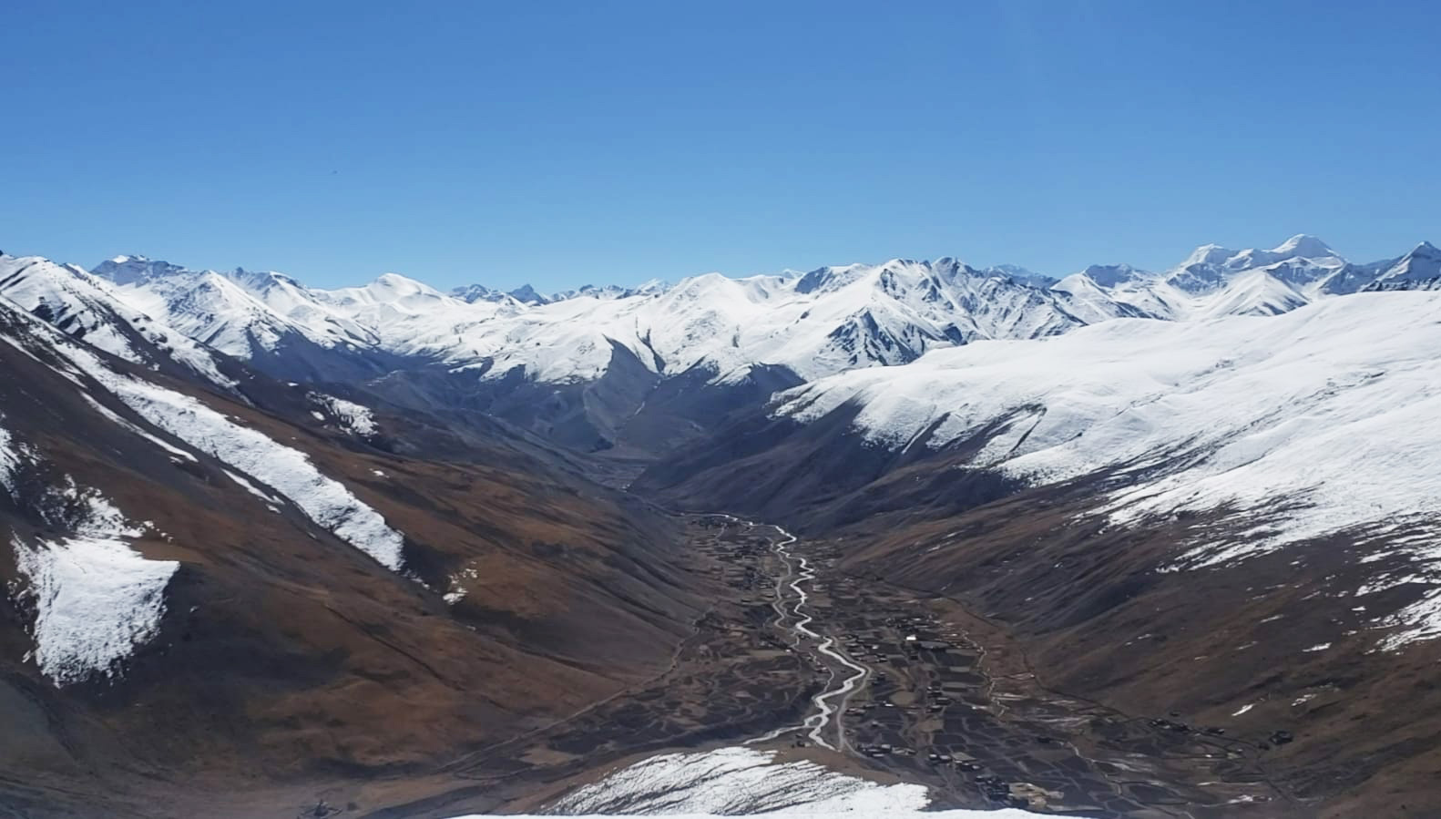
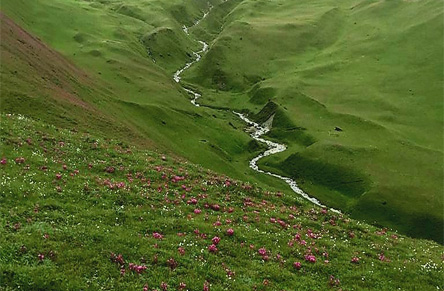
The Lower Dolpo Trek, with its steep, winding paths and muddy hills, is the pinnacle of off-the-beaten-path trekking adventures. This trek goes through two high passes, Numa La Pass (5309 m) and Bagha La Pass (5170m), with a tremendous view of the Dhaulagiri range, Norbu Khang, Kanjerawa, and more snow-capped peaks and mountains. Also, the main attractions of this trek are Shey-Phuksundo Lake, ancient Buddhist and Bonpo monasteries and stupas, shrines, the Tibetan plateau, a dry landscape, and many more. The lower Dolpo trek passes through a number of lively villages with active local customs and cultures.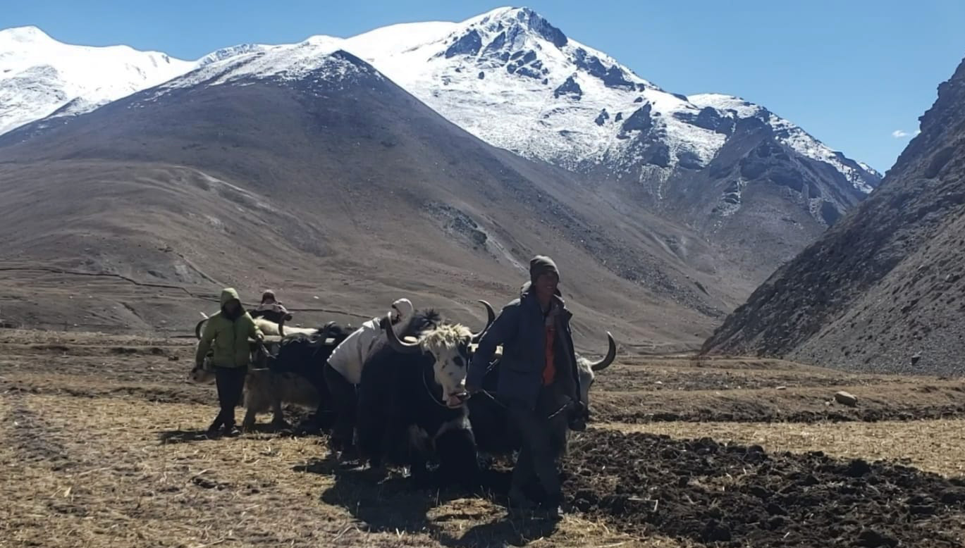
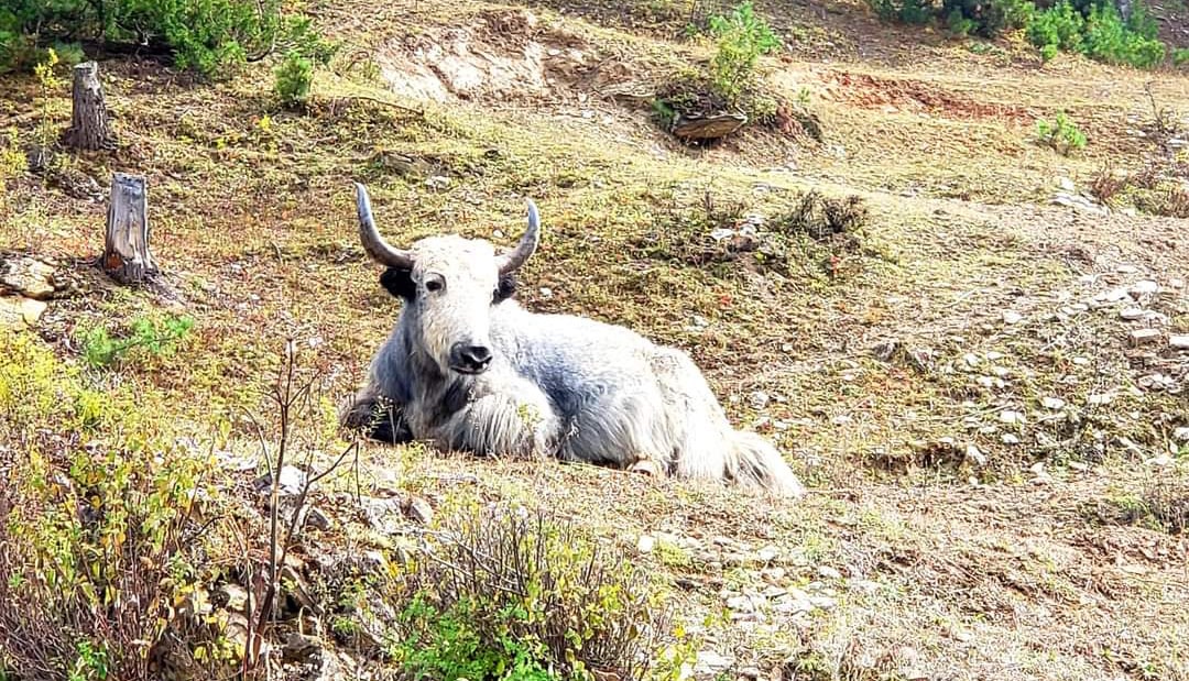
Buddhism and Bon-Po are the two main religions practiced in this area. Apart from religion, the majority of people adhere to a traditional culture and a simple way of life. In addition, this area has incredible wildlife, including snow leopards, blue sheep, ghoral, Himalayan tahr, and black bears, as well as lovely scenic vistas with tall pine, spruce, fir, and birch trees, among many other species.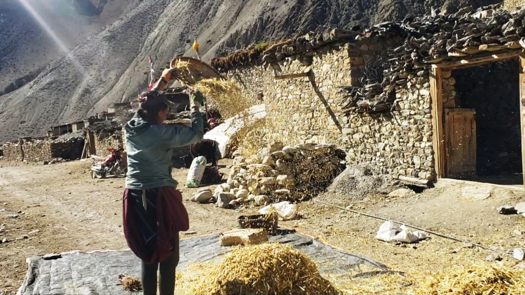
This area is naturally remote and isolated due to the harsh terrain, steep inclines, and high mountain passes. The trek is a little difficult because of these obstacles, but it is impossible to access it in the winter, and the trek is closed because of However, the Buddhist and Bon-Po religions, monasteries, stupas, locals, traditions, and culture, a straightforward village lifestyle, an incredible landscape, and a view of the snow-capped mountains make the 20-day trek an extraordinary and adventurous trek that will be a great experience for the rest of your life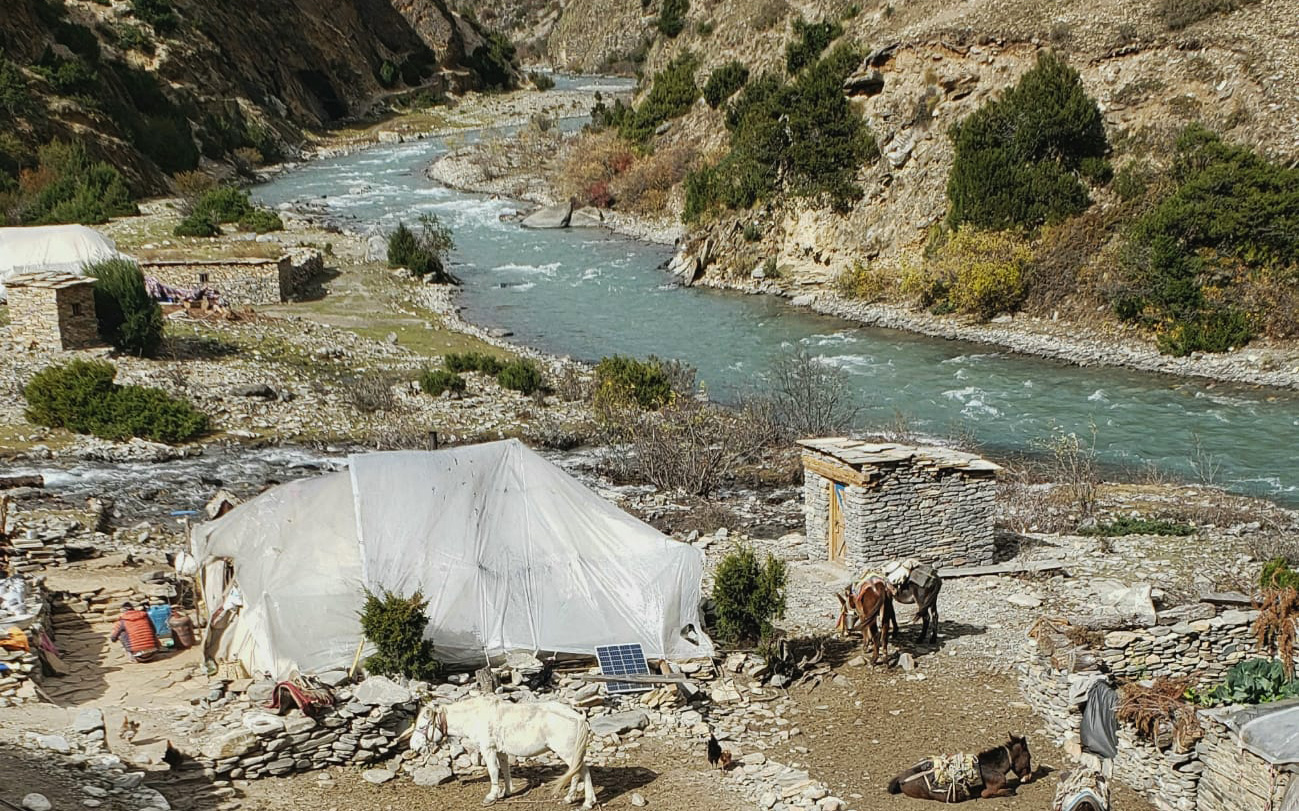
My experience during Lower Dolpo Trek:
On the first day of the trip, after all the setup of equipment we were ready to explore Dolpo. we’ll head to the airport to catch our flight to Nepalganj. Nepalganj, a key commercial hub for many areas of the western part of Nepal, is close to the Indian border. It is a significant city in Nepal and provides access to the remote region of Humla as well as western Nepal. After leaving Kathmandu, it offers a stunning view of the valley and mountains.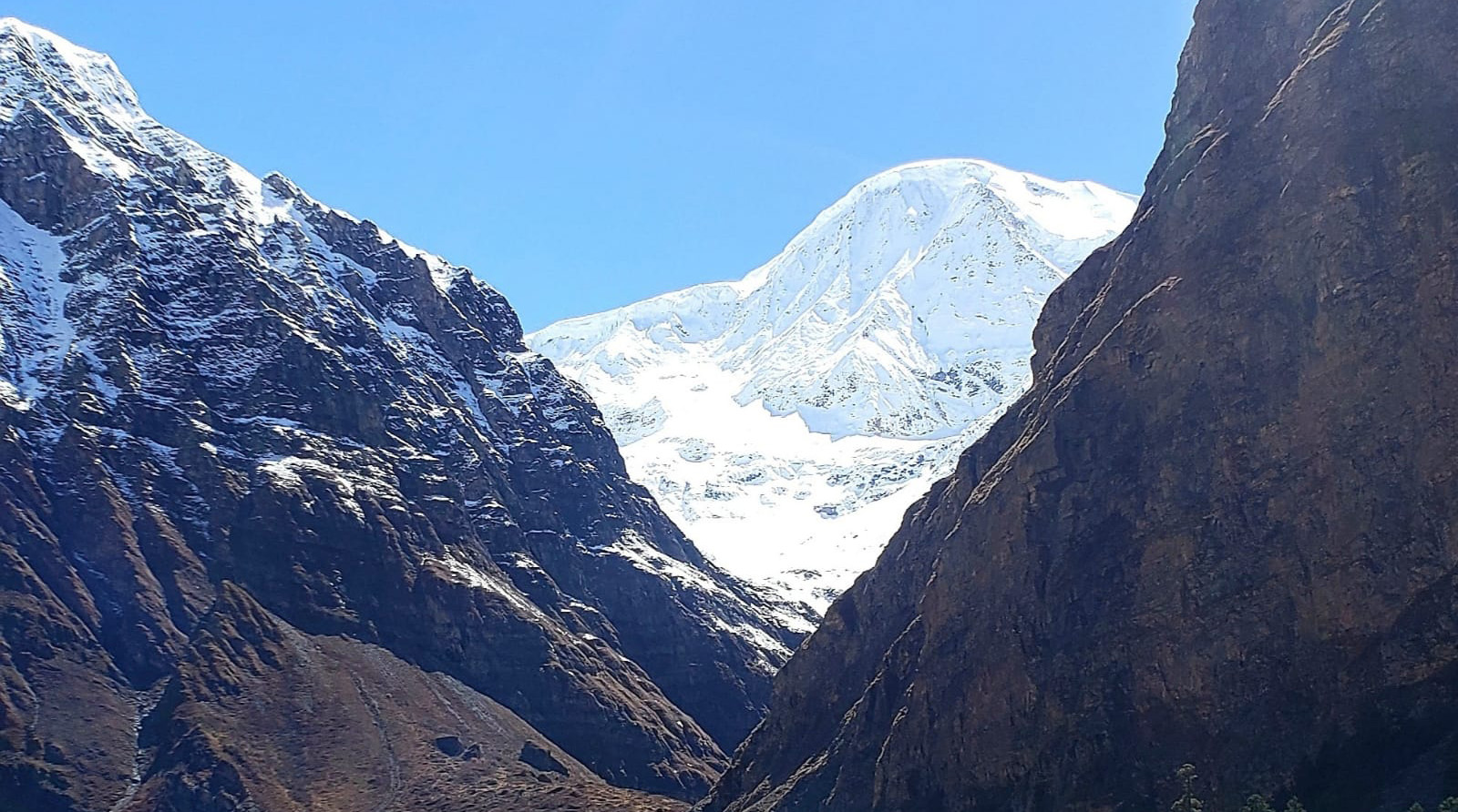
Kathmandu to Nepalganj is 55 minutes flight, but the usual delay of flight took us around 3 hours to reach nepalganj. We stayed in the Megha hotel. It was quite a good stay there. But people who traveled from high place it’s hard to stay in nepalganj for long time, because the reason of Hot. there is extreme hot during spring and summer season. My stay is in Nepalganj only for one night , so it was ok and quite manageable.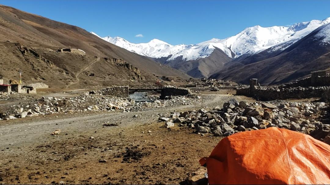
and same day we stayed overnight in a 3-star hotel in Nepalganj. And the next day, early in the morning we took the flight to Juphal dolpo. It was a 45-minute flight to Juphal and after 45 minutes, we landed at Juphal airport. It’s an excellent flight with beautiful views of the Himalayan foothills and the Dolpo valley. We begin our straightforward, four-hour trek to Dunai as soon as we arrive at the airport. Along with the Bheri River, this trek passes through Juphal, a nearby traditional village. In Dunai, we set up camp for the night.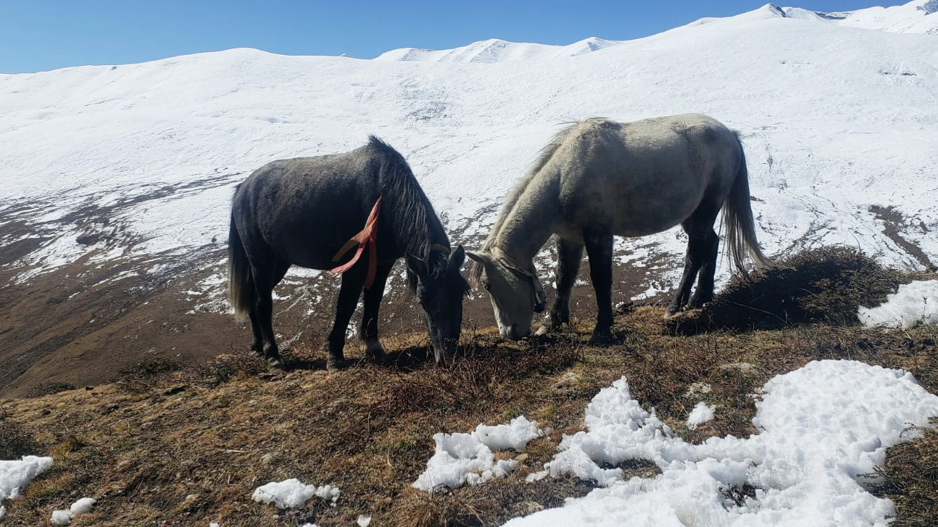
On the second day of the trek, We awoke early this morning, ate breakfast, and then set out on our trek to Tarakot. The trail follows the Bheri River and gradually ascends through a picturesque setting. Along the way, we pass by isolated traditional villages and bridges with a deep drop. After 5 or 6 hours of hiking through the magnificent gorge and dense pine forest, we reached Tarakot.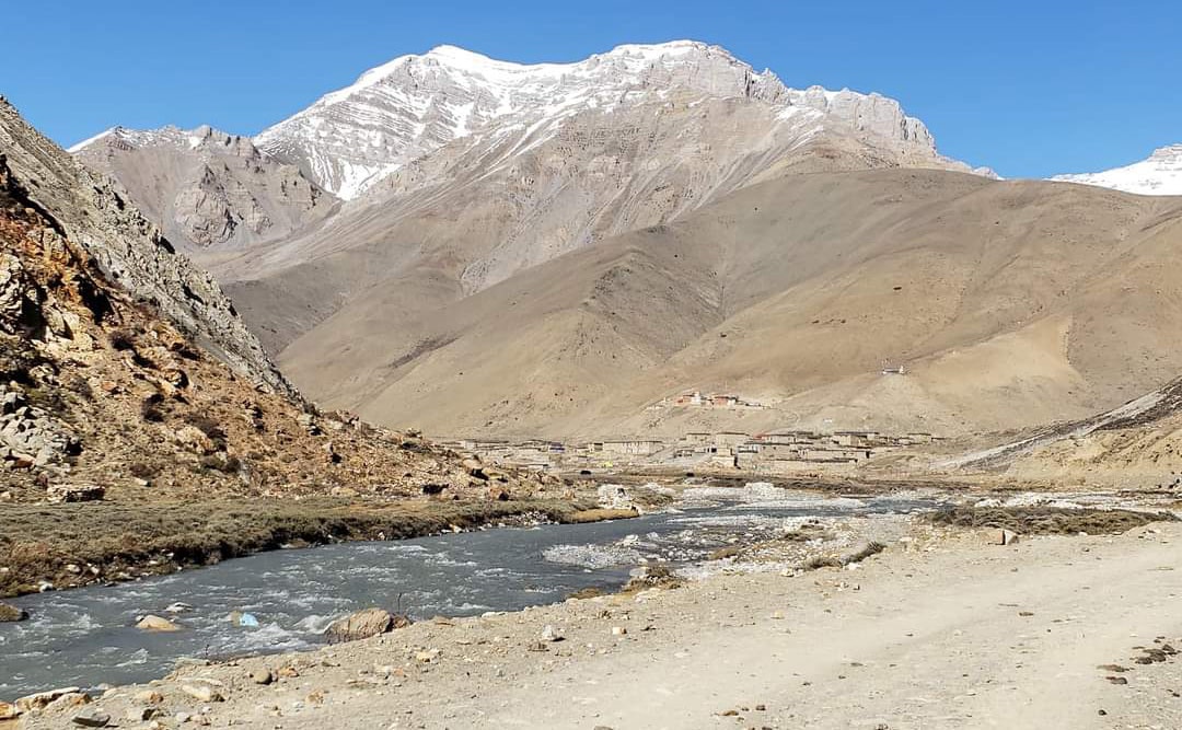
The Tarap River is crossed on the way to the Khani Gaaun on the Laine Odar Trail. Traditional architecture can be found there, and the village’s stunning Sandul gumba adds to its allure. The Sandul Gompa is revered and well-known. After passing Khani Gaaun, the trail begins to incline, and after a leisurely stroll, we arrive at Laine Odar. We set up camp for the night at this location, which is located at 3238 metres.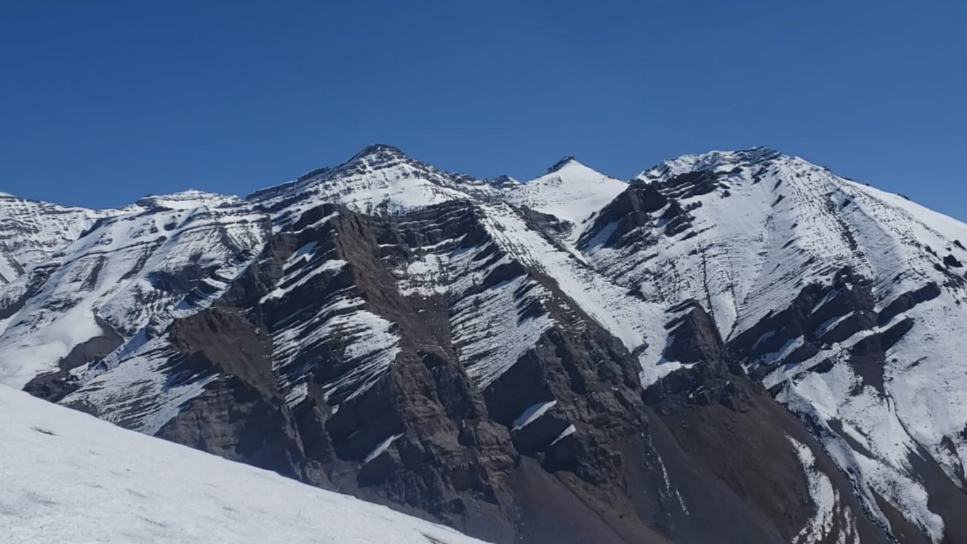
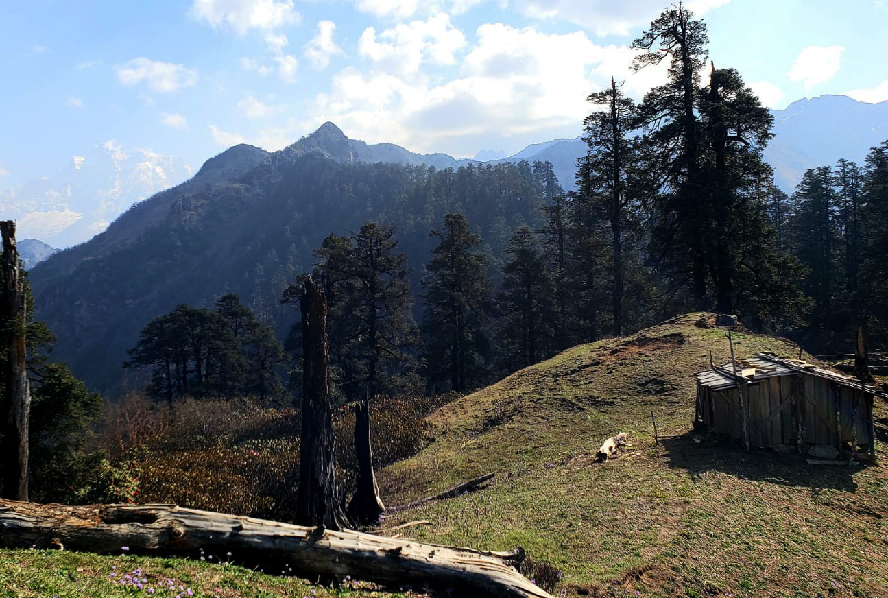
As usual, the next morning we headed in the direction of Nawarpani after breakfast. The path climbs through the confined and precipitous valley. Following the completion of the laine-odar jungle and bushes All the greenery is disappearing as we hike uphill, and it has been replaced by a dry, rocky landscape. There are a few tents, which are like temporary homestays, that are run by the locals. We arrived in Nawarpani after several hours and spent the night in tents there.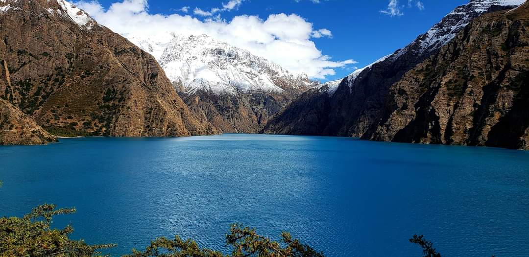
The next day, we started our trek to Dho. The trail following the trip to Dho is absolutely fantastic because of the varied scenery. We continued on the hiking trail until we reached Shusil Khola, where there was a motor road. And all the way to Dho, we saw different and many fauna flora, which was very new for us and very amazing. After a few hours of walking, we arrived at Dho, where we set up camp for two nights.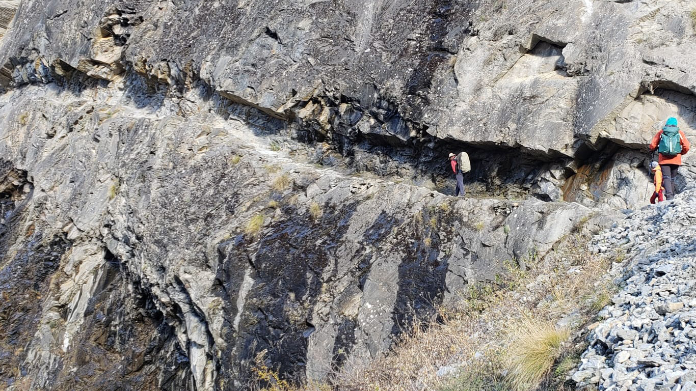
Dho is a beautiful traditional village. Residents of this village follow a fusion of Tibetan tradition, culture, and language. This village’s residents are entirely dependent on agriculture. Unfortunately, they couldn’t grow much in their field. They import necessities from Tibet (China). On the rest day, we explore the Dho village and have the chance to learn about the customs, culture, and way of life there. The Bon-Po religion, with its monasteries, stupas, and mesmerizing views of peaks and mountains, is practiced by the majority of the population in Dho.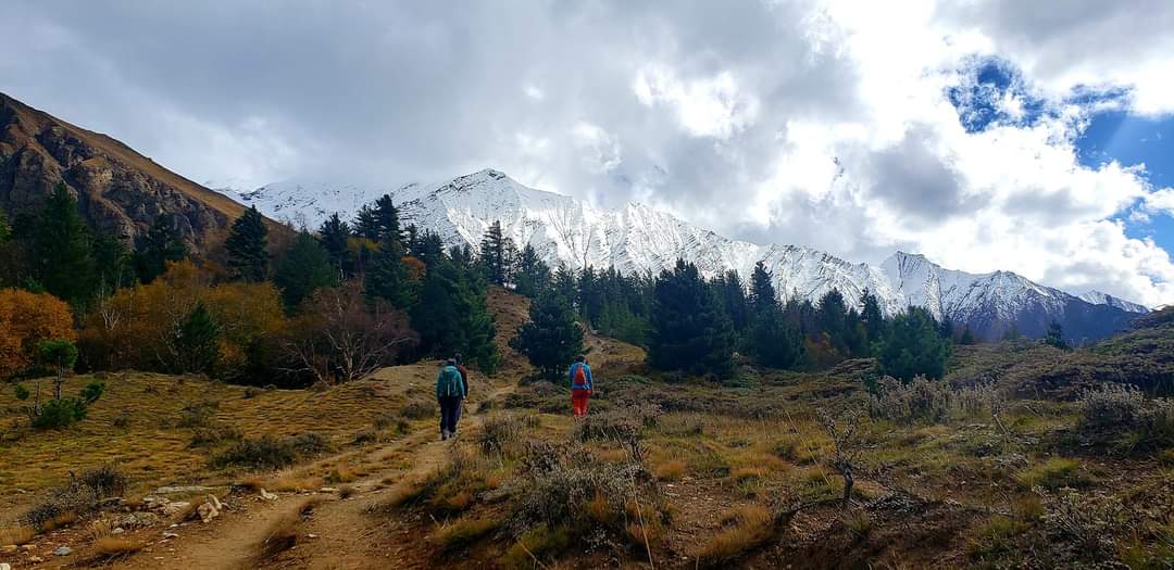
The following day, after acclimatizing in Dho, we moved toward the Numala basecamp along with the Tarap river. A very traditional village by the name of Takiyo is traversed on the route to the Numala basecamp. Very traditional houses that blend Tibetan culture with a simple way of life can be found in this village. The valley of Takiyo is broad and level. After walking some hours we eventually arrived at the Numala basecamp after passing a few monasteries and stupas and Takiyo village along the Tarap Valley Trail.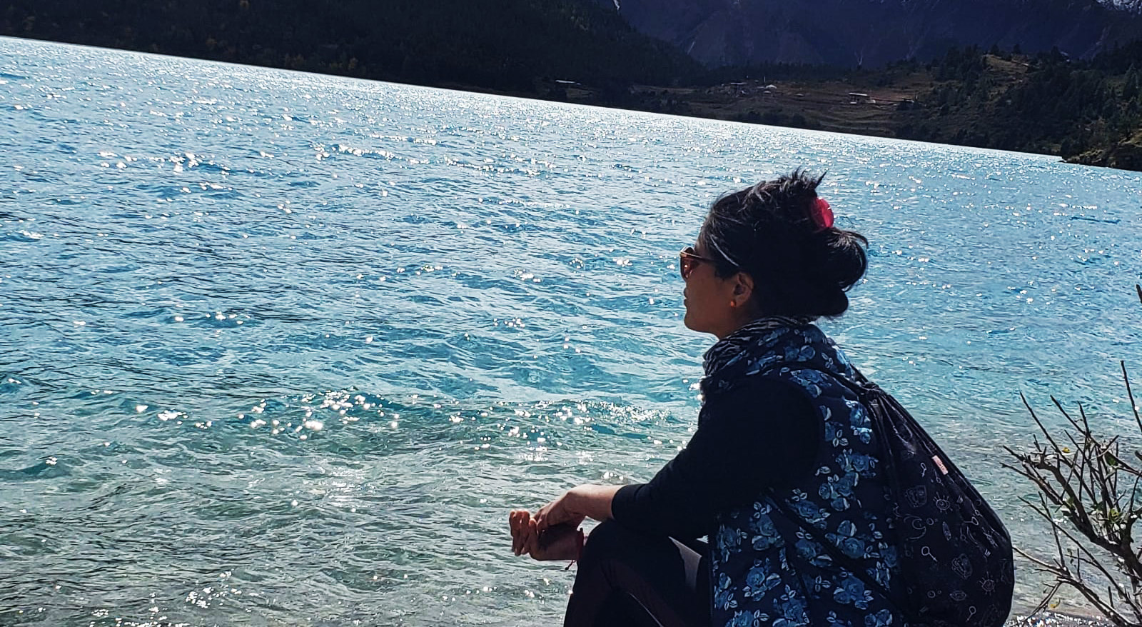
The following day of the trek will be challenging because we must cross the Numala Pass, which is 5310 meters above sea level. We started trekking early in the morning to Danigar via crossing an amazing Numala Pass. Trek to the Numala pass is so adventures. During the pass’s ascent, one can see the breathtaking view of Dhaulagiri range and many different mountains and valleys on both sides of the Numala Pass. On the way to Danighar, there are no homes, no villages, and not even any places to stay, but during the summer, hikers can stay in a temporary house at a yak kharka.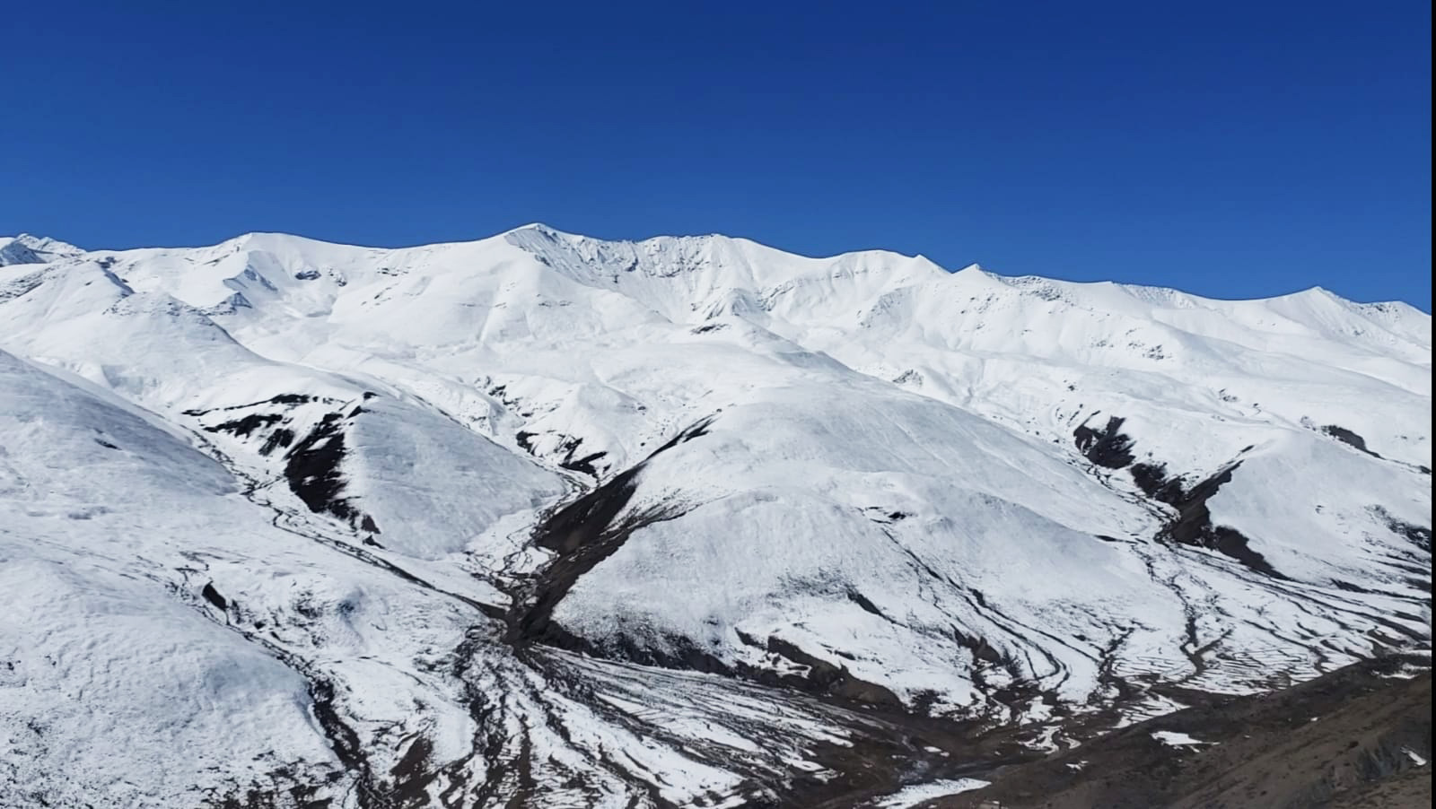
The pass tomorrow is easier than the Numala pass, but the pass today is really difficult. It’s higher than 5170 metres and doesn’t require as much climbing as Numala Pass. Following the triumph of the Numala Pass, we arrived at Dhanighar and set up camp there. We took some time to recover and be ready for tomorrow, as Balaga Pass is truly an experience. It starts with a very hard and daring steep ascent from Danigar to Bagala Pass (5170 m). We climbed for a few hours till we arrived at the Bagala Pass, where we took some stunning photos before descending to Thamcha Camp. We camp beside Thamcha, who is also a yak kharka. Locals visit there yearly in the summer with their yaks and spend their time in temporary shelters. 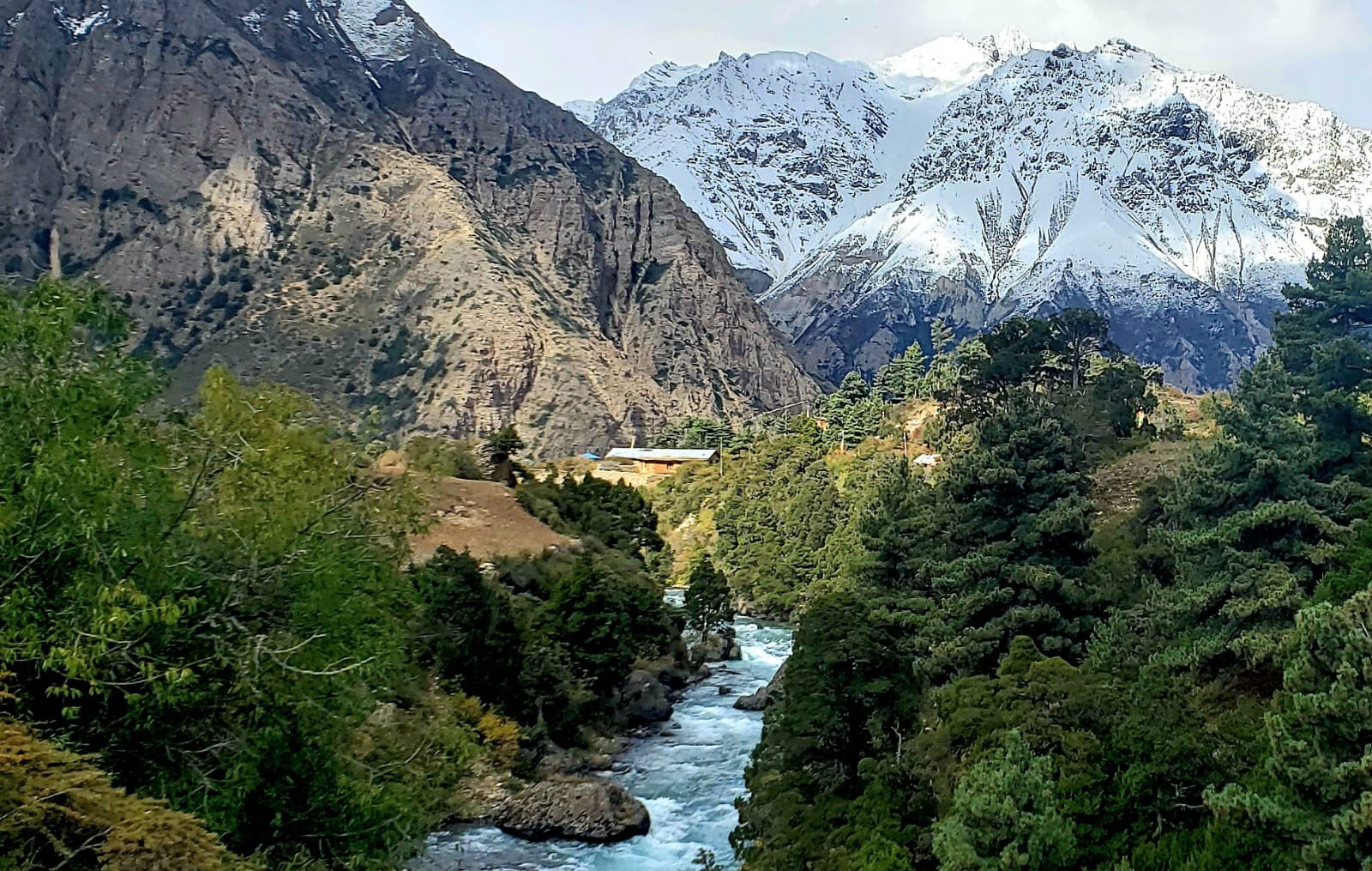
And our next camp is in Ringmo village. The trek to Ringmo village is still barren in most of the place; only in some of the places can we see forested areas with abundant vegetation, including oak, pine, juniper, and cypress trees, which provide breath-taking views of the gorge and water. After walking for a couple of hours, we reached Ringmo village.
Ringmo village is located at 3600 m above sea level, and it is the traditional and beautiful Ringmo village, along with the Shey Phoksundo Lake, the world’s deepest and second-largest lake. Around Phoksundo Lake, we can see the breathtaking Ringmo Valley landscape. There is the Oldest Bon Gumba, which was constructed 900 years ago.
The trek to Chhepka the following day is very magnificent; it follows the flow of the river and affords stunning views of the valley. On our route down to Chhepka, we crossed Jharna, the Tapricha School, and Ranchi before coming to the amazing Phoksundo waterfall. And in Chhepka, we set up our tents. Despite the abundance of lodges, we decided to remain at the camp. and it was enjoyable for us to be there.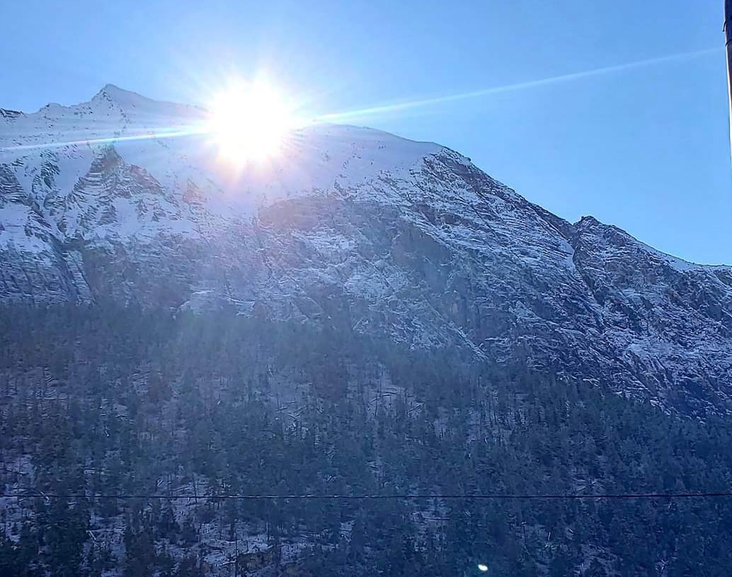
The following day, we left Chhepka after breakfast and made our way slowly down to Juphal. We passed through Shyanta, Kagni, and the Shey Phoksundo Lake checkpoint on route to the main road, where we got into a jeep and headed to Juphal. We would camp that day at Juphal, our last destination on the walk. The next morning, we took an early flight from Juphal to Nepalganj, and the same day, we took a flight in transit from Nepalganj to Kathmandu.
The Dolpo Trek is a challenging, incredible, once-in-a-lifetime adventure.
Recent Post
Ganesh Kund and Kalo pokhari Trekking Trail
Post Date: March 23, 2023
Helambu Trekking- Sacred Valley in Himalaya
Post Date: February 14, 2023